Posts with tag 'Places to See in Central Oregon'
Subscribe and receive email notifications of new blog posts.
 RSS Feed
24
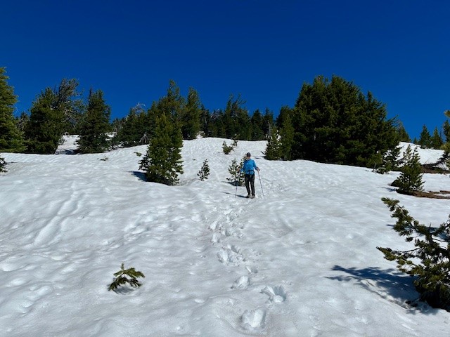
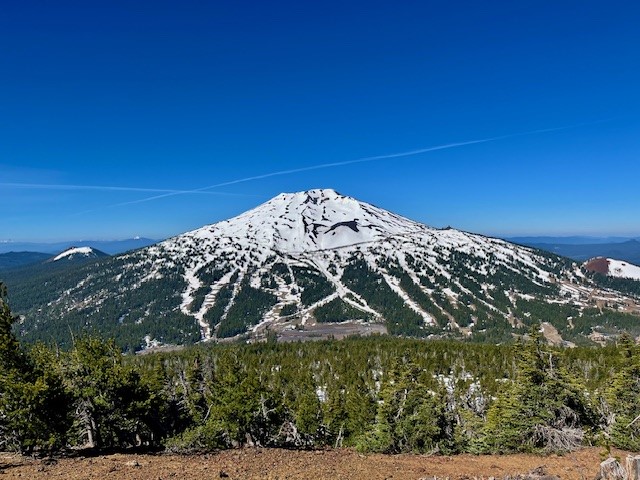
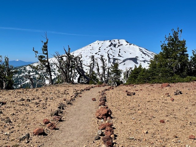
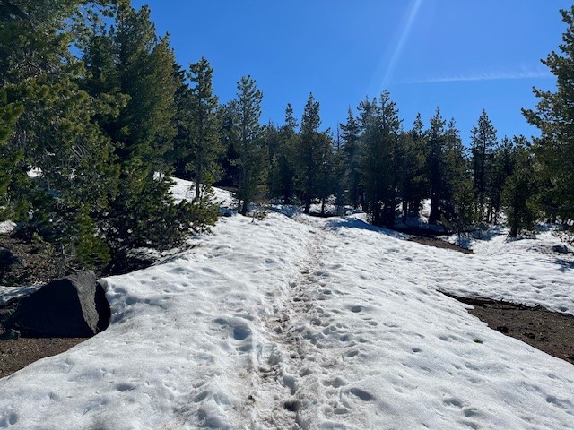
Hike Tumalo Mountain for Stunning Cascade Mountain Views
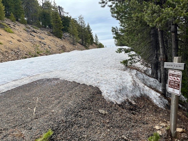
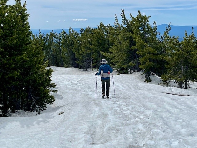
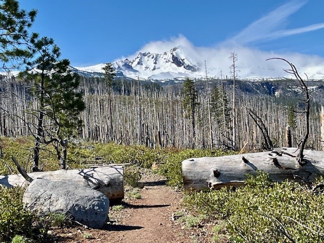
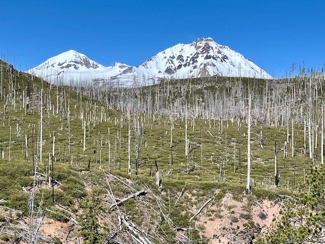
The Hike to Tumalo Mountain Still Has Snow 6-22-24
After a winter which had good snowfall, hiking into the high Cascades has been delayed due to the snow accumulation. However, the warm days experienced over the past week have aided snow melt. Last Saturday, June 22, 2024, enough snow had melted on Tumalo Mountain to enable hikers to walk the 1450 feet of elevation gain in two miles from the trailhead to the top. It appeared as if half the time the trail was covered by snow, but it was fairly easy to follow the route until the last 1/2 mile; GPS helped navigate this as did microspikes over ice.The hike up Tumalo Mountain is only 2 miles, but the views from the top toward South and Middle Sister, Broken Top, and Mt Bachelor can be spectacular. For those who take the hike early in the day, often the only people at the top are those in your group. Tumalo Mountain is a great way to begin the summer hiking in the Cascades.
 |
 |
 |
 |
20
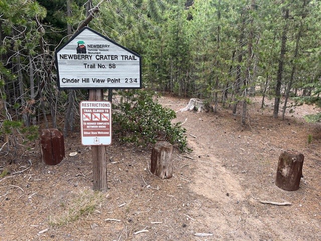
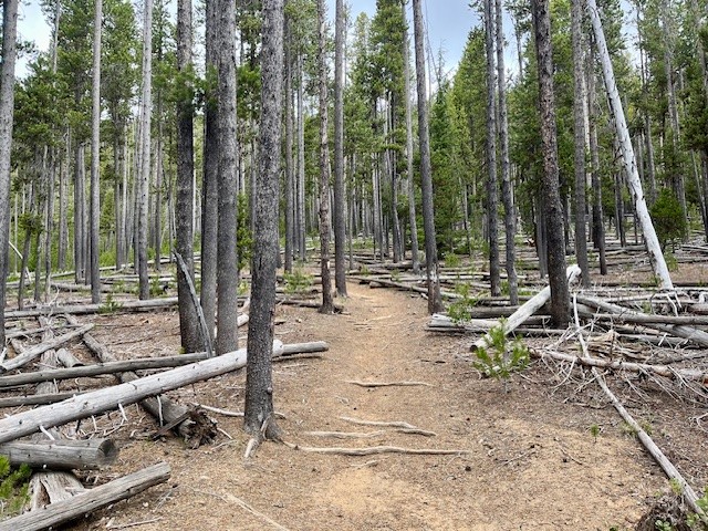
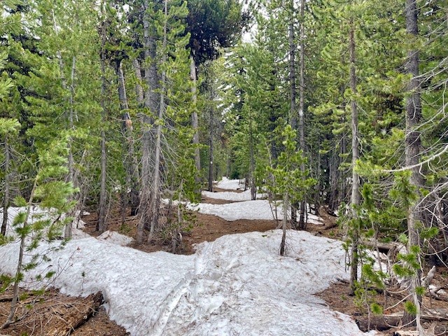
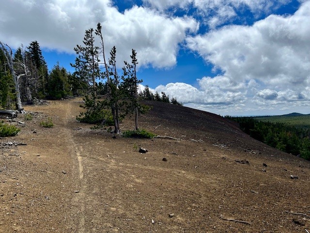
Cinder Hill in Newberry Crater National Monument is a Great Early Hike
Newberry Crater National Monument is Hikeable Now
While waiting for the snow to melt from the higher elevations of the Cascade Mountains, people looking for a Central Oregon hike with mountain views can consider Newberry Crater National Monument. Besides the well-known Paulina Falls, Obsidian Trail, the hike to Paulina Peak, and the various treks around both Paulina and East Lake, there is the relatively little known hike starting at the Cinder Hill campground at the end of the road by East Lake up to the Crater Rim and then to the Cinder Hill viewpoint. Although not the longest hike, there is close to 1000 feet elevation gain over two miles and then the relatively easy 3/4 mile hike along the Crater Rim trail to the view point. The hike from the campground to the rim is not difficult due to multiple switch backs and a gradual incline. The trail is well maintained and at the rim hikers may have to compete with people on mountain bikes to reach the view point.On June 15, 2024, the weather was cool with the temperature in the thirties at 9 am. The hike to the rim had some light snow as well as older snow patches left over from winter to traverse. At the view point, although very beautiful with views of East Lake, Paulina Peak and Paulina Lake, the wind was blowing and the wind chill was well below freezing. Hikers didn't last long admiring the setting.
 |
 |
 |
 |
13
Bend Premier Real Estate | June 2024 Newsletter
What's in the June 2024 Bend Premier Newsletter?
- What are the Puzzling Trends for Bend Home Sales?
- Raspberry and White Chocolate Muffins
- 10 Ways to Prepare Your Home for Summer
- The Road to Paulina Peak in Newberry Crater is Open for Hikers
- The Wealth Building Power of Home Ownership
5
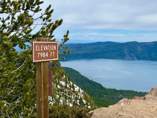
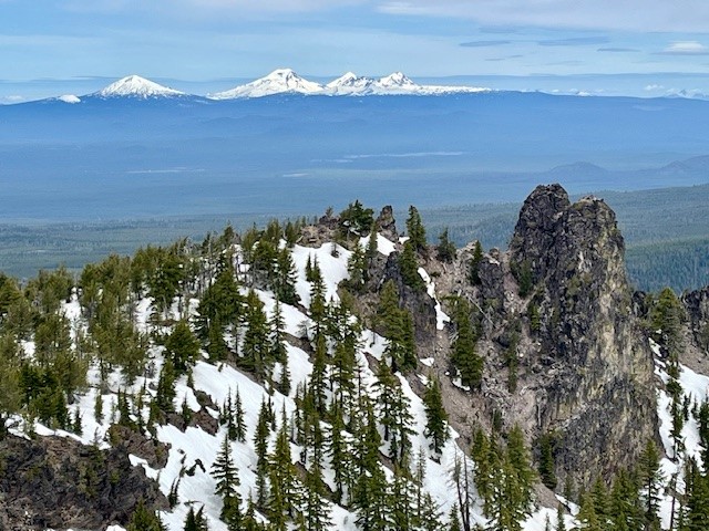
The Road to Paulina Peak in Newberry Crater is Open for Hikers Spring 2024
The Paulina Peak Road Has Snow But it is Melting Fast
Reports about the trail to the top of Paulina Peak in Newberry Crater National Monument on June 1, 2024 stated that the last mile had a lot of snow. Rather than navigate through this and the abrupt steep drop off the last mile of the trail, hikers could elect to walk the road up to the peak. This road was not yet open for vehicles and had snow patches in the shady areas, but was very much passable by hikers. The last 1/2 mile to the peak on the road had three feet of compacted snow, but with the use of trekking poles, it was easily traversed. The views of the snow capped Cascades and Paulina Lake were splendid from the top as were eastern views toward Fort Rock and the Obsidian Flow. Hiking the road results in 1600 feet of elevation gain to the peak which is just under 8000 feet above sea level, but over a more gradual grade than the trail, making for a longer hike but more easily done. All in all, the total hike by the road is just under 8 miles up and back from the gate off the main road through the monument.
 |
 |
 |
 |
30
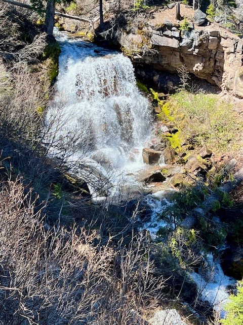
Chush Falls is a Fun Hike Just Outside Sisters Oregon
Chush Falls Is Snow Free
One of the earliest spring snow free hikes in Central Oregon's forests is the hike to Chush Falls. The trailhead is located off the road to Three Creeks Lake outside of Sisters several miles down a gravel road and then a short trek up a narrow dirt and rock road. The parking area is small so people wanting to hike the relatively short 2.2 miles to lower Chush Falls should plan on arriving early to get a parking space.
The trail starts in burned forest - the result of the 2017 Milli Fire. However, unlike the experience with earlier hikes, almost all of the burned trees from this fire which have fallen across the path have been cleared which makes the trek to Lower Chush Falls fairly quick. One result of the fire are the views of North/Middle Sister and Broken Top are more unobstructed. And the new young trees are getting taller and starting to be seen through the manzanita and snowbrush.
 |
|
For those who really want to see Lower Chush Falls, there is a steep scramble down the hillside to the base of the falls; the viewpoint at the top is disappointing with tall trees and vegetation obstructing views. However, for those who can tackle the steep hillside, the views of the falls from the base are wonderful.
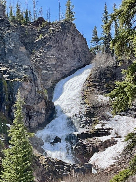
After climbing back up to the viewpoint, hikers can elect to return to the trailhead or continue on to Upper Chush Falls past smaller Cascades Waterfall. This path has not been cleared of fallen trees, so it is much slower to hike over, under and around the tree trunks. However, for those who make it to the trail's end, it is surprising to see the 200 foot waterfall; Lower Chush Falls is 50 feet. The vegetation is thick at the base of Upper Chush Falls with the canyon Whychus Creek flows through steep so it is challenging to really get a great view. The easiest access for photos is up the hillside above the creek over an unsteady rockfall. All in all, for those who make it to Upper Chush Falls, the total hike is 6.5 miles with 961 feet of elevation gain.
 |
 |
Privacy Policy / DMCA Notice / ADA Accessibility