Posts with tag 'Places to See in Central Oregon'
Otis's blog
 RSS Feed
Subscribe and receive email notifications of new blog posts.
RSS Feed
Active Lifestyle Things to do in Bend | 1 Posts
Bend Makes Another List | 3 Posts
Bend Oregon Real Estate Trends | 63 Posts
Bend Premier Real Estate Listings | 1 Posts
Bend Premier Real Estate News | 25 Posts
Bend Real Estate General Information | 126 Posts
Bend's Best Bites | 1 Posts
Central Oregon Real Estate | 22 Posts
Central Oregon Real Estate Market Trends | 9 Posts
Finance | 1 Posts
Fun Real Estate Facts | 1 Posts
Great Oregon Hikes | 56 Posts
Happenings in Bend | 7 Posts
Luxury Real Estate | 8 Posts
Neighborhoods to See in Bend Oregon | 4 Posts
Newsletters | 34 Posts
Places to See in Central Oregon | 18 Posts
Redmond Oregon Real Estate Trends | 7 Posts
Uncategorized | 3 Posts
Why We Love Central Oregon | 18 Posts
July
17
17
Marion Mountain Hike has Lakes, Mountains and Waterfalls
Marion Mountain Hike has it All in Central Oregon
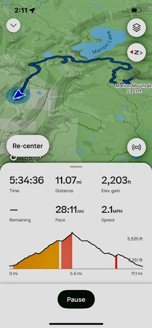
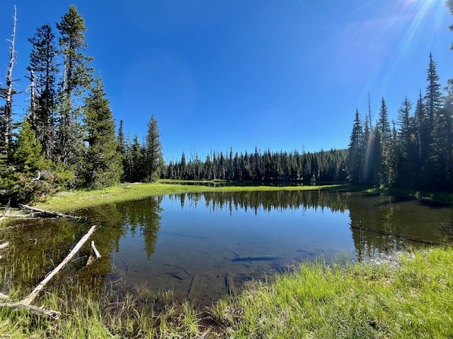
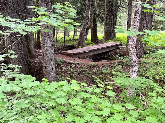
Past Santiam Pass off Hwy 22 over the bridge at Marion Forks is the turn off to the trail head for Marion Lake/Mountain. Hikers have to travel over 5 miles down a paved, then decent gravel road to the trail head and must present a forest pass to hike the trail. Once past the trail head, hikers climb two miles through old growth forest until they reach Lake Ann, accessing the lake shore over a stone covered creek which flows from the lake. The trail skirts the end of Lake Ann and after a half a mile, reaches Marion Lake.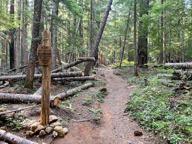 |
 |
 |
 |
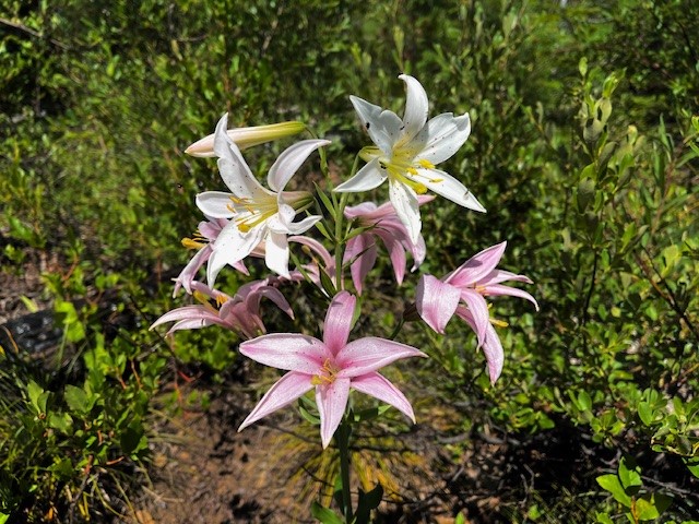
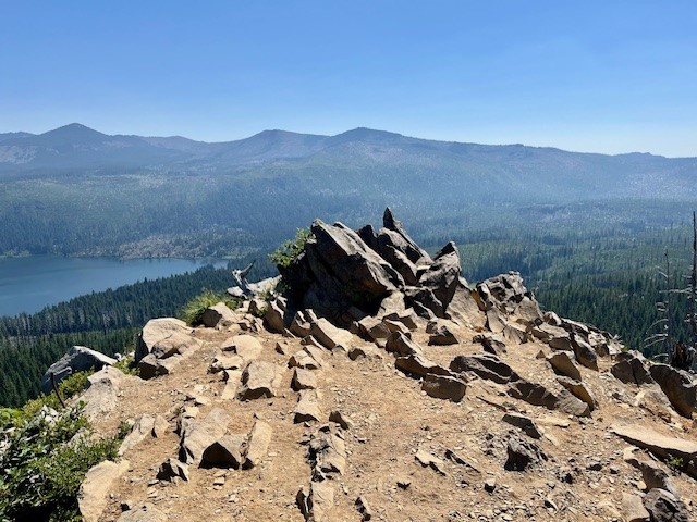
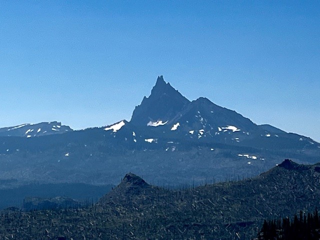
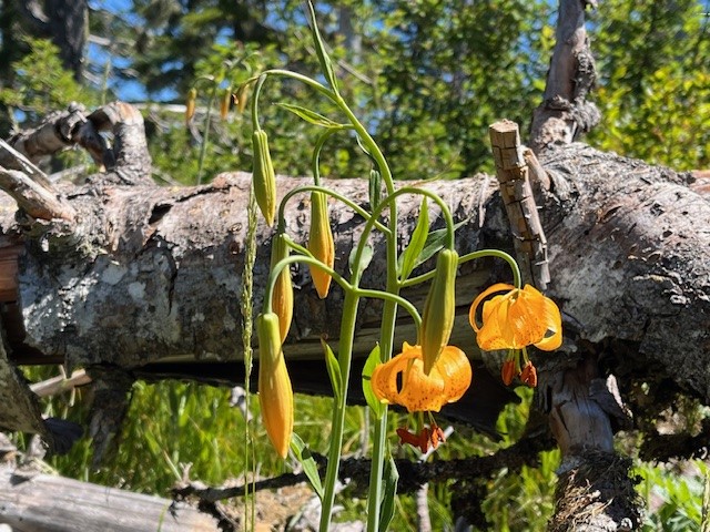
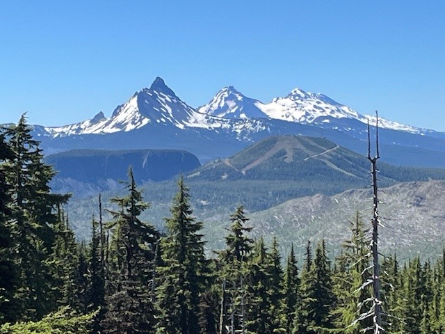
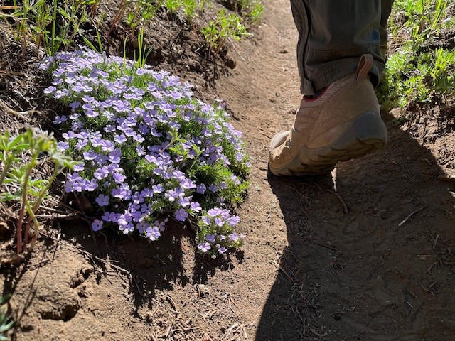
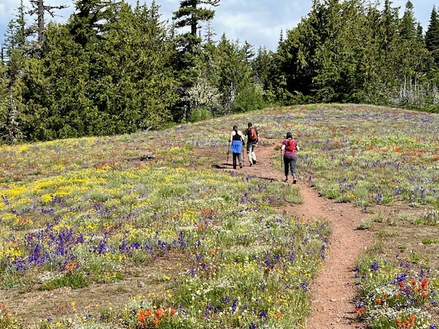
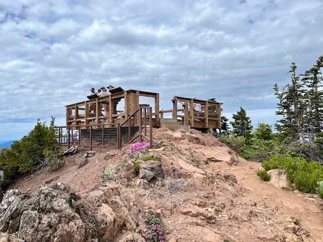
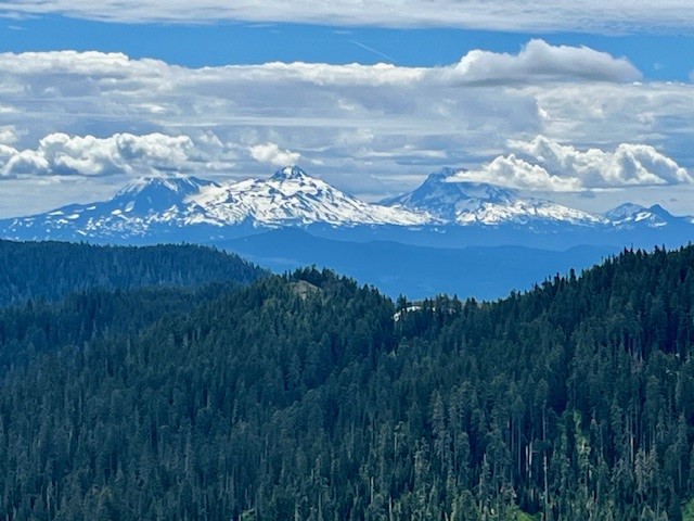
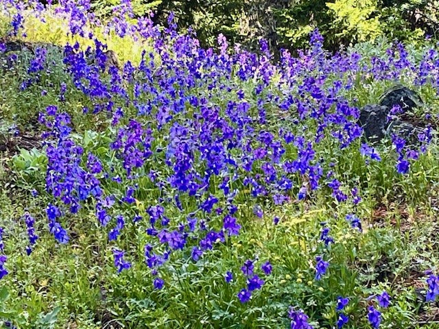
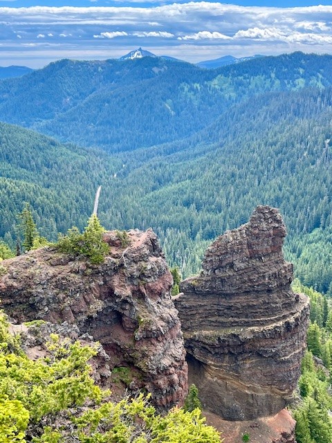
The trail splits here. Hikers wishing to take the path next to Marion Lake can do so, and others wishing to bypass the lake and travel on to either Marion Falls or Marion Mountain can do that. The path to Marion Mountain connects again with the path next to the lake, but past the lake the path steepens as hikers gain elevation hiking up Marion Mountain. There are scattered open areas (complete with the remnants of forest fires) and forested areas as the remaining miles to the top of the mountain are climbed. At the top of the mountain the views of Mt Jefferson and Three Fingered Jack are wonderful. The viewpoint is on a narrow rocky outcrop with steep drop-offs on each side. On July 13, 2024, butterflies and summer wildflowers were abundant.
 |
 |
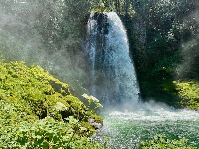
On the hike back to the trail head, an unmarked path near the Marion Lake junction leads to Marion Falls. Hikers to the falls have to traverse over and around downed trees and a very steep path to get to Marion Falls. However, seeing the falls up close is wonderful. There is another steeper path to access the lower falls which adventurous hikers can take. The negative of seeing the falls up close is the steep path - which has to be climbed to get out and back to the main path back to the trail head. All in all, the total distance traveled was over 11 miles with over 2200 feet of elevation gain.
 |
 |
July
11
11
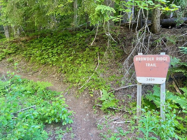
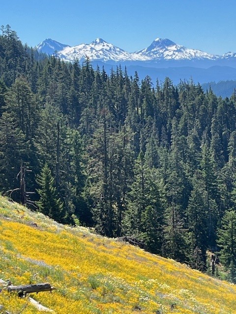
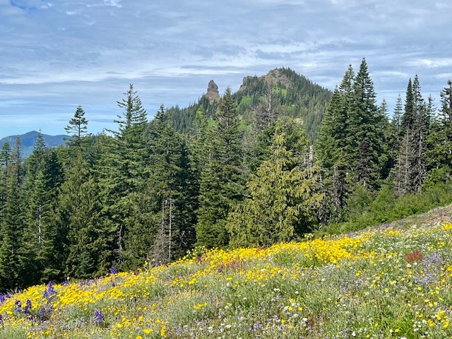
Browder Ridge is a Little Known Hike with Amazing Wildflowers
Browder Ridge Has Outstanding Cascade and Wildflower Views
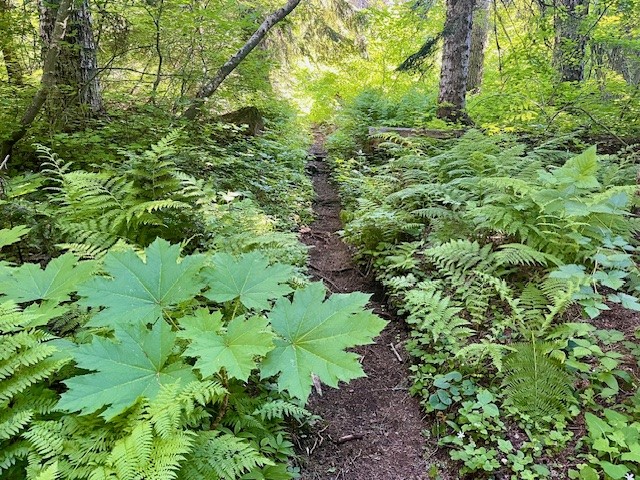
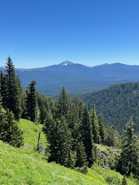
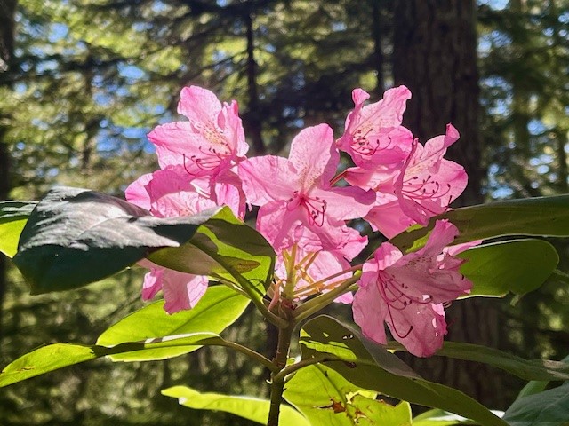
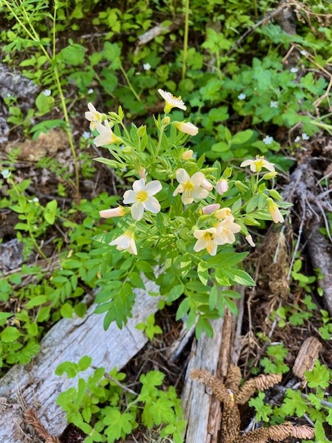
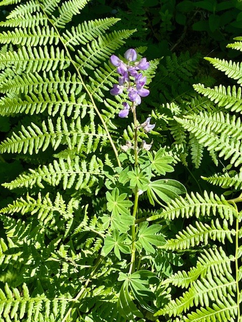
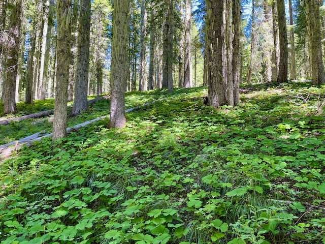
The little known Browder Ridge hike is an alternative to the well known Iron Mountain hike many take during wildflower season. Iron Mountain is located off Hwy 20 near Tombstone Summit. The easiest access to Browder Ridge Trail is near the Iron Mountain trailhead a few miles up paved forest service road 15.The first few miles of the hike are in forested old growth with a lot of shade; ferns, rhododendrons, and various shade-loving ground cover plants are evident in this section of the hike.
 |
 |
 |
 |
 |
 |
 |
 |
 |
 |
July
11
11
Bend Premier Real Estate | July 2024 Newsletter
What's in the July 2024 Bend Premier Newsletter?
- Bend Home Prices Up As Are Inventory Levels
- Filipino BBQ Pork Skewers
- 9 Tips to Keep Your Home Cool Without AC
- Maxwell Butte Trail
- Things to Avoid After Applying For a Mortgage
July
7
7
Be Surprised at the End of Maxwell Butte Trail
Maxwell Butte is a 10 Mile Hike in the Willamette National Forest
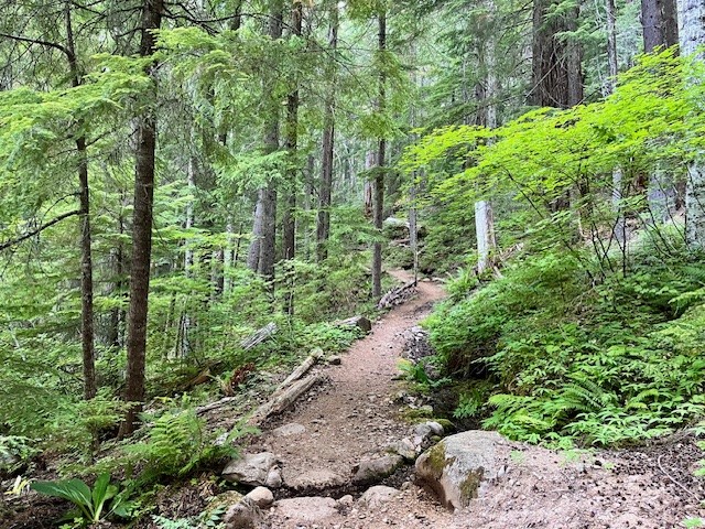
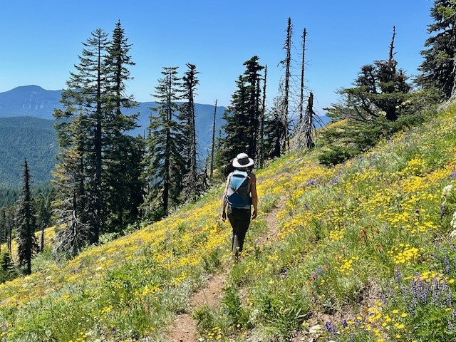
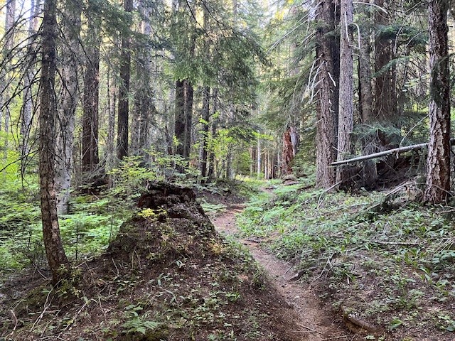
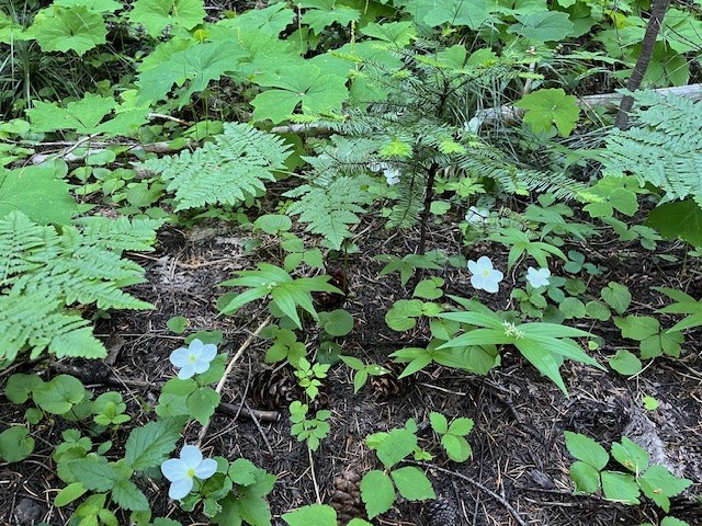
The 4th of July 2024 was a clear and beautiful day to hike in the forests of Oregon's Cascades. Despite a few mosquitoes in the early hours of the hike, the well marked trail to the top of Maxwell Butte was cleared of fallen trees and only had a few snow patches once the trek up the butte itself began. However, the walk through the woods was lovely with many shade-loving wildflowers blooming and no one else seen.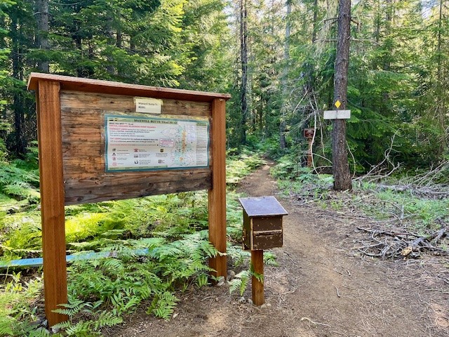 |
 |
 |
 |
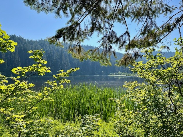
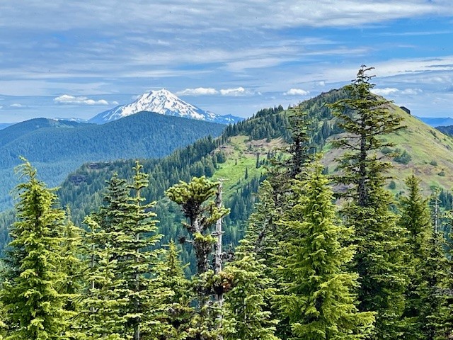
After passing small Twin Lakes and the junction with the Lava Lakes Trail, the hike passes through more woods and open areas until the final push up Maxwell Butte starts. The trail steepens and switchbacks and as hikers gain elevation, the views towards North and Middle Sister, The Husband, the Wife and then Broken Top become visible. The topography of Hogg Rock, Hoodoo and Hayrick Butte become very evident as hikers climb. However, it isn't until the peak of Maxwell Butte is reached before the stunning views of Three Fingered Jack become seen. Three Fingered Jack's western flank fills the view from the top of Maxwell Butte. Turning slightly west, the views toward Mt. Jefferson, Mt. Hood and the multitude of small and larger lakes in this section of the Willamette National Forest and Jefferson Wilderness were obvious, as were the results of many fires experienced in Central Oregon over the past few years. All in all, the hike to the top of Maxwell Butte is slightly over 10 miles with 2500 feet of elevation gain.
 |
 |
 |
 |
July
3
3
The Return to Iron Mountain 2024
 |
 |
 |
 |
 |
 |
 |
 |
 |
 |
Privacy Policy / DMCA Notice / ADA Accessibility
This site is hosted, designed and copyright
© 1994 - 2026 by
Delta Media Group, Inc. -- Patent Pending --